LiDAR 3-D Building Scanning
What is 3-D LiDAR point cloud scanning?
Simply put, it is a far superior way to digitally measure things, like buildings, to make a precise record of our built environment.
We can measure buildings in a fraction of the time with far superior accuracy than other methods.
Li·DAR noun: stands for “Light Detection and Ranging”, is a system which works on the same principle of radar, but uses light from a laser for faster and more accurate results.
The resulting clusters of millions of points measured in virtual 3D almost look semi-transparent, like a cloud, and is often referred to as a point-cloud.
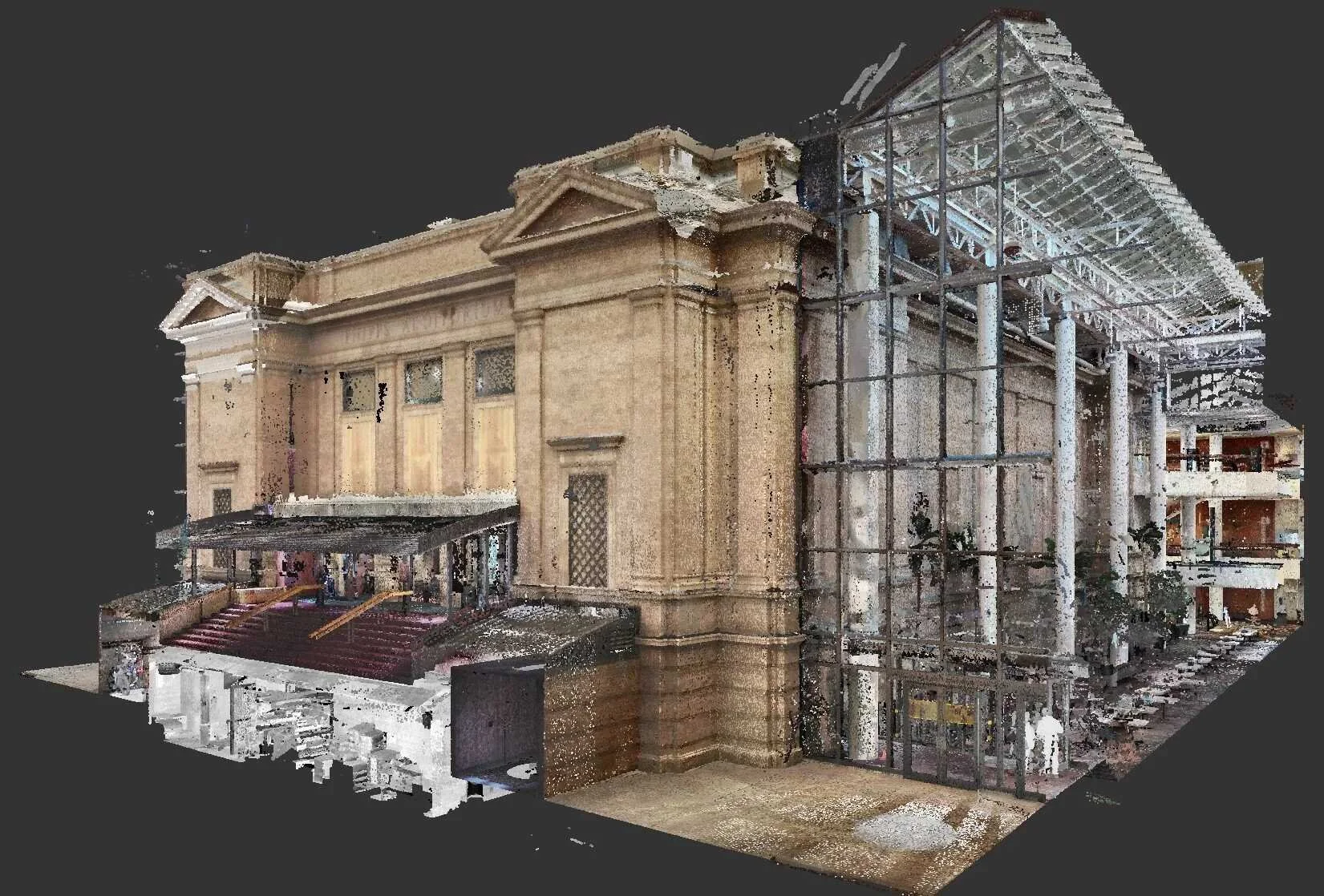
Denver Museum of Nature and Science | 3-D LiDAR Point Cloud Scan
LiDAR 3-D Scanning
Solid Tech is an expert at scanning building interiors and exteriors. From small retail spaces to large high rise office buildings.
Scanning building interiors is a particularly demanding practice in 3-D scanning compared to typical survey or terrestrial scanning due to challenging factors like line of site for interior spaces. Solid Tech’s teams specialize in building scanning and have processes and tools specially developed to cope with these demanding conditions.
We will tailor scanning services and equipment selections to meet the speed and detail level required for your project.
Scanning services can be provided as a stand alone service or paired with other services like BOMA Rentable Area Analysis, Lease Exhibits & Marketing Plans, or Scan-to-BIM Services.


Mobile 3-D Scanning
Mobile scanning technology has revolutionized the practical use of laser scanning in all sorts of industries, including real estate and architecture. Regardless of if you are scanning teeth for Invisalign braces, power lines from a drone, or the hundreds of rooms and offices in a building, the technology that lets you scan while you move is called SLAM (Simultaneous Location and Mapping). Devices enabled with this technology enable users to continuously scan while walking a floor, greatly speeding up the process of scanning large floors with many small rooms in minuets rather than hours or days. These scanners take between 40k and 4M individual measurements per second with a laser with sub centimeter accuracy. An on-board computer tracks the movements and builds the 3-D layout as it goes, based on the laser readings and additional sensors.

Stationary 3-D Scanning
Tripod mounted scanners, often referred to as terrestrial scanners, rotate for a 1 to 3 minute scan for each scan location but provide a greater degree of accuracy (up to the sub millimeter level). But the accuracy comes with greatly increased scan time on-site as well as the time off site with the amount of data and number of scans that must be processed and registered. However, when precise measurements for fabrication are required, this is the kind of precision that is called for.
Recent advancements are making it easier to combine terrestrial and slam scanning into a single registered point-cloud.